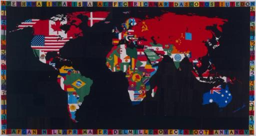
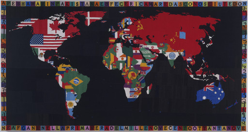
Colored pencil, pencil, and acrylic on map on five boards
Not on view
Instead of depicting national borders, in his Map of America Juan Downey represents the South American continent as a swirl of colors. In response to a military coup in his native Chile, he embarked on a journey in 1973, traveling from New York to the southernmost tip of South America. Along the way, he videotaped the regional cultures he encountered throughout South America and showed the footage to people he met in the hope that he might bridge the isolation between different communities if they could find commonalities in their everyday experiences.
Downey’s footage became the basis for the installation Video Trans Americas. Map of America and similar drawings accompanied his videos. In this work, he uses the hand-drawn map as a galvanizing symbol to foster a more unified, transnational Latin American identity.
Gallery label from A Trip from Here to There , March 15–July 30, 2013.
Map of America presents South America in a swirl of colors devoid of national and geographic boundaries. Physical, mental, and social movement is central to the work, which Downey made in conjunction with a road trip from New York through Central and South America. The Chilean-born artist had lived abroad—in France, Spain, and the United States—for nearly a decade, and the trip was the result, he has said, of “a wish to take root once again in the essence of that which was Latin American.” During his travels, Downey videotaped aspects of regional cultures and showed local people his footage to share information and undermine isolation between communities. He later combined his video footage and richly drawn, evocative maps like this one to create the 1976 multimedia installation Video Trans Americas.
A Trip from Here to There, March 15–July 30, 2013.
Explore more
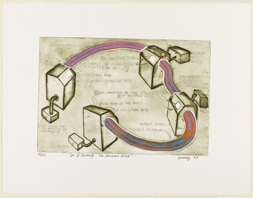
Juan Downey
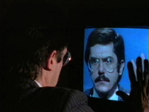
Chilean, 1940–1993 15 works onlineFrom the late 1960s until his death in 1993, the Chilean-born artist pursued an expansive and deeply philosophical artistic practice combining architecture , technology , and anthropology to question how we understand humanity and represent people from Latin America who have been historically exoticized.
Learn more →
Maps, borders, and networks
People have been creating maps since ancient times. The earliest map, thought to be a schematic representation of the night sky, was found in the caves of Lascaux, France. It dates to 14,500 BCE.
Learn more →


From MoMA Design Store


Installation views
We have identified this work in the following photos from our exhibition history.
Licensing
Artwork or archival images
If you would like to reproduce an image of a work of art in MoMA's collection, or an image of a MoMA publication or archival material (including installation views, checklists, and press releases), please contact Art Resource (publication in North America) or Scala Archives (publication in all other geographic locations).
Audio and film clips
MoMA licenses archival audio and select out of copyright film clips from our film collection. At this time, MoMA produced video cannot be licensed by MoMA/Scala. All requests to license archival audio or out of copyright film clips should be addressed to Scala Archives at [email protected]. Motion picture film stills cannot be licensed by MoMA/Scala. For access to motion picture film stills for research purposes, please contact the Film Study Center at [email protected]. For more information about film loans and our Circulating Film and Video Library, please visit Circulating Film and Video Library.
Text from a publication or the archives
If you would like to reproduce text from a MoMA publication, please email [email protected]. If you would like to publish text from MoMA's archival materials, please fill out this permission form and send to [email protected].
Feedback
This record is a work in progress. If you have additional information or spotted an error, please fill out this feedback form.