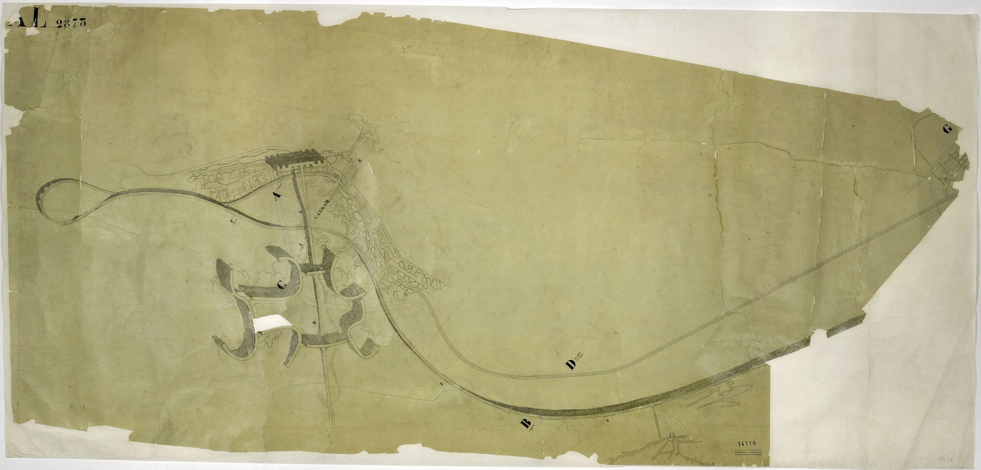
Curator, Barry Bergdoll: In 1932, the architect presented a plan for the African city of Algiers to mark its 100th anniversary as a French colony.
Architect, Jean-Louis Cohen: This plan is meant to completely reorganize the city of Algiers, and is based on the integration of road infrastructure, a gigantic viaduct for a freeway, and the city itself. The freeway is not only a means of transportation; it is also a building. It is meant to be inhabited under the roadway.
Barry Berdgoll: In Algiers, Le Corbusier spent a lot of time sketching and painting the local landscape and people.
Jean-Louis Cohen: It can be said that he translates into the realm of architecture the supple forms that he had observed in the bodies of Algerian women. With the plan for Algiers, Le Corbusier breaks with the octagonal shapes of his previous city plans.
Barry Berdgoll: To Le Corbusier’s disappointment, this plan was never built. Still, his ideas endured.
Jean-Louis Cohen: The ideas migrated to other areas. Many of the young Brazilian architects who were fascinated by the work of Le Corbusier built chunks of it in Rio de Janeiro. And in Algiers younger architects in the 1950s implemented some small segments that can be considered as pieces of the initial grand design.